![Item #6522 L'Europe (suivant ses Nouvelles Divisious). Map]. Charles-Francois Delamarche.](https://krysikbooks.cdn.bibliopolis.com/pictures/6522.jpg?width=768&height=1000&fit=bounds&auto=webp&v=1594578263)
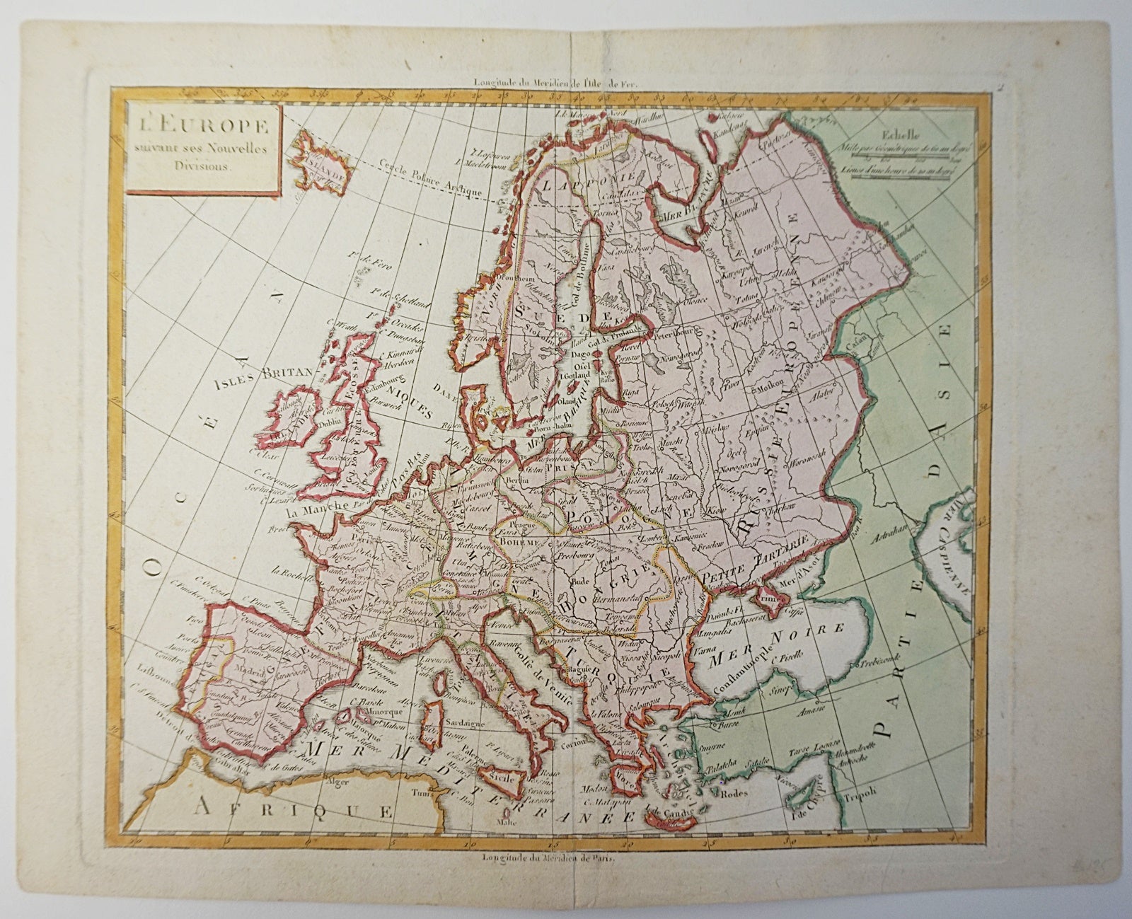
L'Europe (suivant ses Nouvelles Divisious). Map]
Paris: 1783. Very Good. Item #6522
From Petit Atlas Moderne. Delamarche, Charles-Francois. Paris (1783). Copper engraved map, hand coloured. Sheet dimensions [220 x 270mm]. Map dimensions [200 x 230mm]. Vertical fold running along centre of map. Some aging. Great condition. Map of Europe, with country divisions of the time. Detailed listings of towns and cities, as well as bodies of water and mountains. The north tip of Africa is shown at the bottom of the map, and the western part of Asia is visible on the right side of the map. Charles-François Delamarche (1740-1817) was a French cartographer and geographer, who worked mainly in mapmaking, globes, and the reprinting of atlases from his predecessors.
Price (CAD): $75.00