![Item #6544 Carte de l'Ocean Meridional Dressee pour Servir a l'Histoire Generale des Voyages. Map]. Jacques Nicolas Bellin.](https://krysikbooks.cdn.bibliopolis.com/pictures/6544-1.jpg?width=768&height=1000&fit=bounds&auto=webp&v=1594955529)
![Carte de l'Ocean Meridional Dressee pour Servir a l'Histoire Generale des Voyages. Map].](https://krysikbooks.cdn.bibliopolis.com/pictures/6544-2.jpg?auto=webp&v=1594955529)
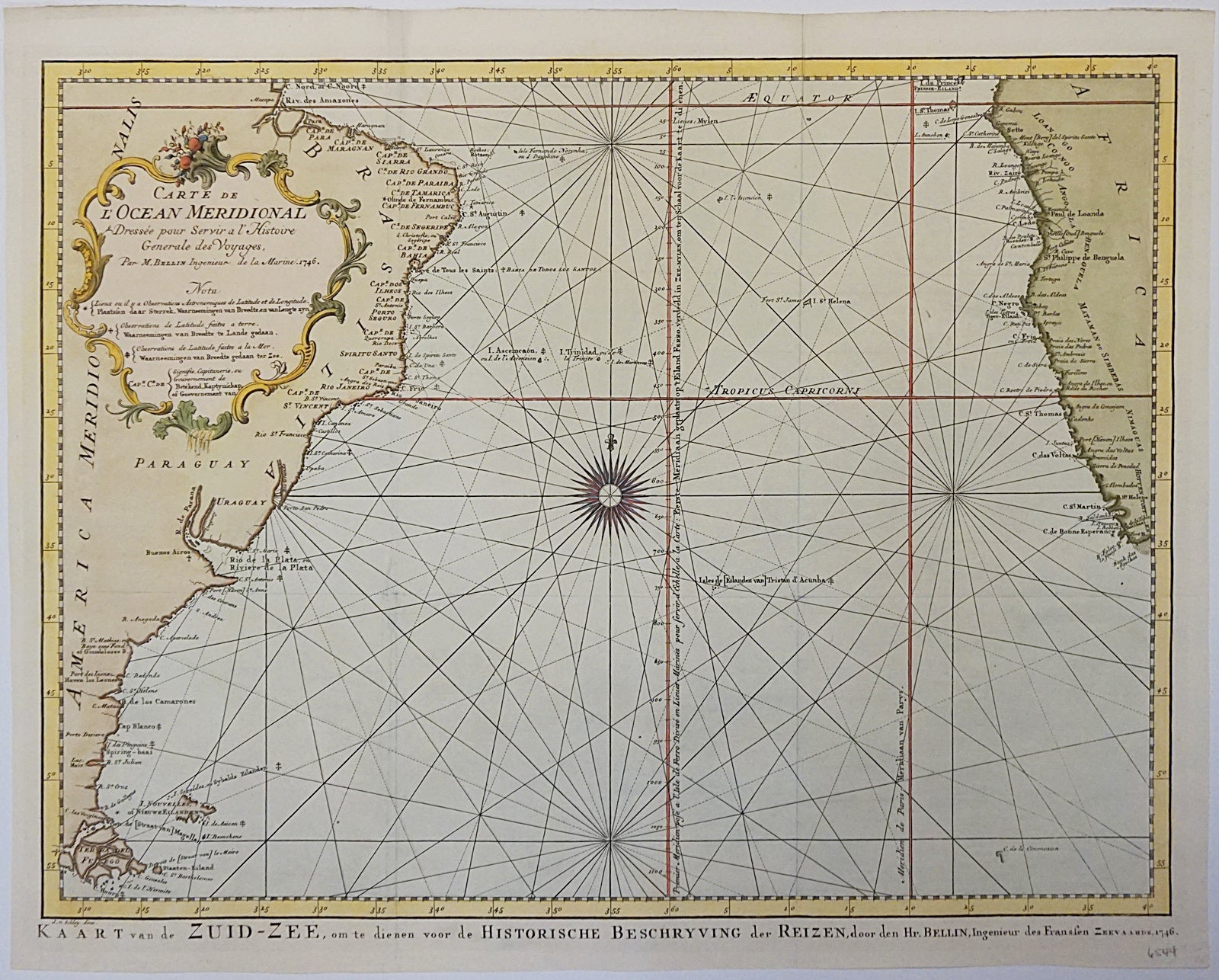
Carte de l'Ocean Meridional Dressee pour Servir a l'Histoire Generale des Voyages. Map].
Paris: 1746. Very Good. Item #6544
(1746). Copper engraved map. Hand coloured. Sheet/map dimensions [380 x 470mm]. Two vertical folds, one horizontal fold. Mounting archival tape on verso top edge. Very faint tearing at top of sheet, does not affect map. Excellent condition. Sea chart/nautical map of the South Atlantic Ocean, showing parts of South America and Africa. The Tropic of Capricorn is labelled, and other nautical coordinates are highlighted. A very decorative cartouche is in the top left-hand corner of the map, showing floral and gold designs. Intricately done and highly detailed, like most Bellin nautical maps. Jacques Nicolas Bellin (1703-1772) was a French geographer and hydrographer. Over the course of his career, he was the official hydrographer for France's hydrographic office and he also worked for the Royal Society of London. Bellin's high standard of accuracy pushed France to the forefront of European cartography and geography, and influenced many mapmakers of the time.
Price (CAD): $400.00