![Item #6651 Neira. View]. Jacques Nicolas Bellin.](https://krysikbooks.cdn.bibliopolis.com/pictures/6651.jpg?width=768&height=1000&fit=bounds&auto=webp&v=1598184459)
Neira. View].
1754. Item #6651
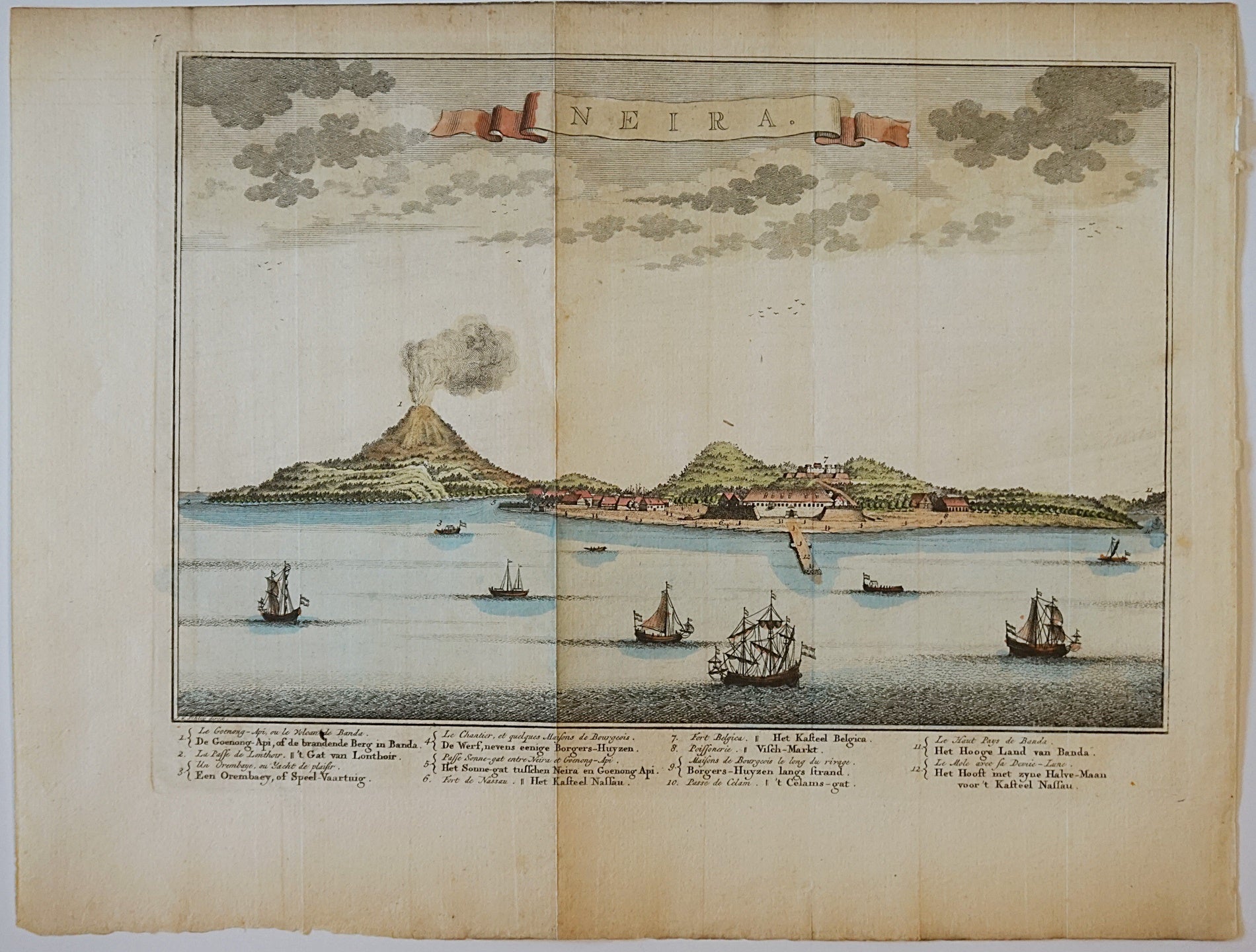
Neira. View]. Published in Histoire Generale des Voyages. (1754). Copper engraving. Hand coloured. Sheet dimensions [270 x 340mm]. Map dimensions [210 x 290mm]. Three foldmarks running vertically down sheet. Very light darkening around edges of sheet. View of Banda Neira island. Shows volcano, buildings on island, ships sailing in foreground. By cartographer Jacques Nicolas Bellin (1703-1772). Bellin was the hydrographer and chief cartographer for the French Navy, as well as the Official Hydrographer of the French king. He created many maps over his career, often with a speciality in the marine world.
Price (CAD): $150.00
See all items in
Maps, Prints, Posters
See all items by Jacques Nicolas Bellin